Hello Everyone!
For starters, for those that haven't voted yet, please do so. Just a few days left in the voting to see where Captain Tedward and his beautiful wife, Kim, fly to for their next adventure. So far, Marianna, Florida and Milledgeville, Georgia are tied with 4 votes.
Ok, so last week, I got a taste for a good hamburger. Oh yeah! The 100 dollar kind! I had to visit the Hard Rock Cafe again. It has one of the best burgers out there! So, my friend Christina and I headed out for the airport yesterday morning. Christina works with me at Netjets and is also a pilot.
I pre-flighted the aircraft, called for my IFR clearance and off we went for Myrtle Beach!

Taking off on Runway 25 at Beaufort County Airport.

Good view of the bridge that leads to Lady's Island in Beaufort.
We climbed up to 7,000 feet and the visibility was horrible due to haze. Our route of flight took us over Charleston, SC and the enroute time was about one hour and 11 minutes. About 25 miles from Myrtle Beach, approach control started our decent and it looked as if we may get the ILS approach into Runway 18. Approach vectored us fairly close in to the airport to see if we can visually see it. I finally saw the airport about 7 miles out and got cleared for the visual approach.

Airport coming into view.

Turning final to Runway 18.
We taxied in and parked on the large ramp at Myrtle Beach Aviation. The line staff was great! After securing the plane, we were driven up to the main building and we proceeded to sign in and get a crew car. The lady working behind the counter there needs a serious lesson in customer service. That is one of the complaints I have had with this FBO and have read many of the same.
We walked out and got into the crew car (2 hour limit but free!). Low and behold, no gas! It's below "E" and the gas light is on. Well, I went back it to see if there was a gas station nearby. Guess what? Old faithful behind the counter doesn't offer me another vehicle but does tell me where there is a gas station. I told her that was great but I hoped I had enough gas to get there! She then hands me a number to Enterprise and tells me to call them if I run out on the way. Now that's the kind of customer service I can live without!
We made it to the gas station, put a few bucks in the tank, and headed off to the Hard Rock.

Outside of the Hard Rock Cafe in Myrtle Beach

Christina posing on the bike out front.

Inside the Hard Rock Cafe.
Lunch was great as usual and it was pretty busy. The service was incredible too. Friendly wait staff and the manager stopped by to chat with us as well. We both had cheeseburgers since that is their specialty.
After lunch, we headed back to the airport and proceeded on our trip back home.

View of the Midwest Connection planes sitting dormant on the ramp.

Takeoff roll on Runway 36. Notice the route of flight on the GPS.

The commercial airline terminal building.

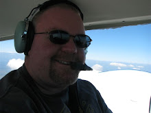
Profile view of Captain Tedward at work.
Due to traffic in the area, we were not allowed to climb up to our requested altitude of 8,000 feet. We leveled off at 6,000 feet and once again, haze was very prevalent. I allowed Christina some time at the controls and soon we were approaching Charleston. I started to notice a towering cumulus cloud complex ahead of us on our flight path. I called Charleston approach and they advised no weather between us and our destination airport. Soon the clouds grew darker and I had to deviate around the west side of a small thunderstorm cell.

Small thunderstorm cell over Charleston.
Knowing that it was going to be hard to locate the airport at Beaufort through the thick haze, I asked for the RNAV GPS approach into Beaufort and was granted the request from ATC. The approach went well and we touched down back at our home airport about 2:45pm local time.
What a great day we had!
Captain Tedward


