"So where to this week?", Barry asks me one day at work. I told him I'd have to look for a cool place when I got done doing work-related stuff. He told me he'd scope it out and within minutes, he said to look at KCOI, Merritt Island, Florida. It did not take me more than a second to agree as I visited this area back in college when I flew my father up from Miami for one of his business meetings.
We departed Beaufort County Airport (Barry at the controls; I'm working the radio) around 930am on an IFR flight plan that consisted of the following route: KELER v437 OMN V3 INDIA and then into KCOI. After we got handed off to Savannah Approach, they cleared us direct CATHY intersection which saved us a little time. This particular route took us about 16 miles off the coast at its farthest point...right about abeam Fernandina Beach, Florida.
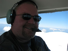
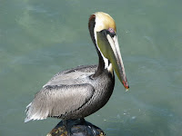
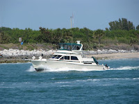
The first several photos show downtown Savannah, Georgia and the coast. After that, you will see pictures of Grills Seafood Restaurant and Tiki Bar and Jetty Park, which include pictures of Barry, a manatee, a cat, a guy cutting up his catch, a couple of pelicans, a casino boat, a tug boat, a fishing boat, a submarine, and a cruise ship belonging to Royal Caribbean. The final shot is on the moon rising off our right wing as the sun sets off to our left.
On the way back, I flew and Barry worked the radios. We were cleared up to 5,000 feet...right in the middle of a row of cumulous clouds. I got about 30 minutes of actual instrument time. As it was getting dark and going through the clouds was a bit bumpy, we opted to climb to 7,000 feet for a smooth ride home. After passing HOTAR intersection (about 16 miles off Jacksonville), ATC cleared us direct to 73J (Beaufort County). That was incredible! Now, we were going to be about 30 miles off the coast, at night, in a single engine aircraft. Kinda freaky but at the same time, VERY COOL! About 40 miles out, we began to see the lights of Savannah and we ended up flying right over Hilton Head Island on the way in. Simply a superb trip!


